Nature
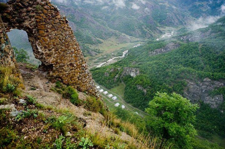
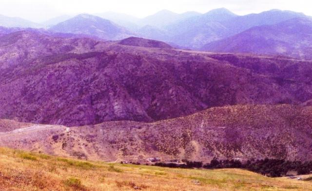
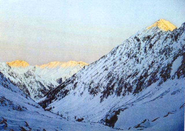
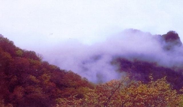
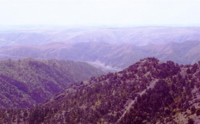
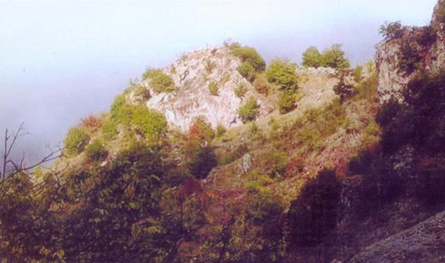
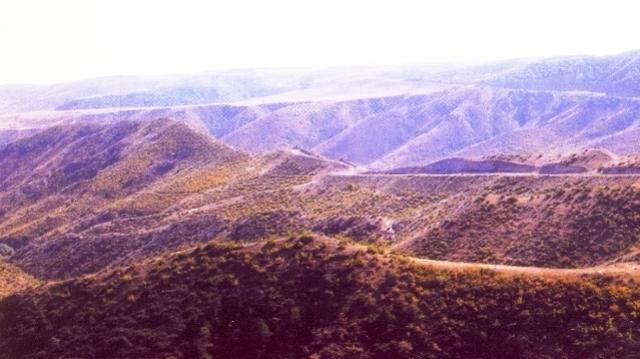
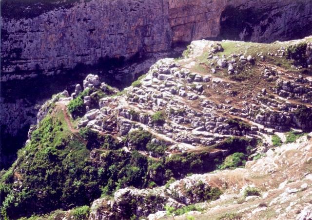
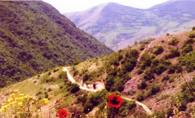
The region in the south-west of Lesser Caucasus includes the areas of Jabrayil, Fizuli, Khojavend, Aghdam, Khojaly, Tartar, Shusha, Khankendi. The relief is mainly mountaineous. The north part of Nagorno Karabakh economic- geographical region is north-east bottoms of the Karabakh range, south slopes of Murovdagh range ( the highest peak of Caucasus Gamish mountain (3724 m), the central, west ,and south parts are eastern slopes of Karabakh range (Gizgala mountain (2843 m), Girkhgiz (2827 m), Boyuk Kirs Mountain (2725 m), northern- east and east parts are west edges of Karabakh and Mil plains. It borders on Iran Islam Republic in the south and south-east. The Murovdagh and Karabakh ranges are divided into some side branches lowering towards Karabakh and Mil plains. In the result of break of ranges and their side branches with rivers there appeared deep and steep slopes. In the middle upland, in the areas, where river valleys expand, there are intermountain lowlands. The forests in the area are 187,7 thousan hectares.
The relief of the area of Aghdam is mainly flat, partly mountainous. The maximal altitude is about 1365m. Jabrayil region is basically located on the sloping plain (Injechol, Geyan field). The climate of Jabrayil region is temperate semi-desert with dry summer and dry steppe climate in the south part, moderate hot with dry summer in the north. Mountain chestnut, chestnut and brown mountain forest soils are spread. The relief of Fizuli region is mostly sloping plain descending towards the Araz, it consists of low mountains in the west, gray and gray meadow, chestnut and light chestnut, mountain chestnut, mountain gray brown soils. The landscape of Tartar region, which is located on the west of Kura-Araz lowland, is flat inclined from west to east with a climate of temperate semi-desert, with dry winter and dry steppe climate. Mostly chestnut, gray , and gray meadow soils are spread here.
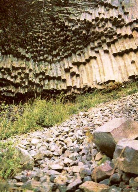
In geological structure collateral tectonic elements of Caucasus Murovdagh, Karabakh, Aghdam antycliniorums and separating Toraghaychay and Khojavand synclinoriums take the main place. The arch of antyclinoriums consists of volcanic rocks of Middle Jurassic, remote wings of the arch, and the synclinal structures complicating them contains limestone of Upper Jurassic, volcanogenic and sedimentary rocks of Chalk. They are cut with intrusions at times.
In the lower parts of plains and river valleys anthropogenic sediments are spread. In January, the average temperature is 2-0.50 C in plains and foothills, –4; -130 C in high mountains, in July correspondingly 25-260 C and 15-140 C. In high mountains annual rainfall is more than 800-900 mm. The peaks of Murovdagh range are snowy topped all year round from time to time. The main rivers are The Kura- its tributaries Tartar, Khachin, Gargar, and the Araz, its tributaries Kondelenchay, Guruchay, Gozluchay and others.
At the same time, in these areas 4 types of mammals, 8 types of birds, 1 type of fish, 3 types of amphibians and reptiles, 8 types of insects, 27 types of plants, which are included in “The Red Book of Azerbaijan”, were protected.
Vegetation. Chestnut,light chestnut, mountain dark chestnut, dark brown mountain and forest, brown mountain and forest, blackish mountain, etc. soils are widely spread. The soils of the area of Aghdam region are mainly chestnut, light chestnut, and dark brown mountain-forest soils.
Land cover. The area which is rich in vegetation more than 2000 types of plants grow. In low-lying areas wormwood, semi-desert covered with wormwood- salinegrass, in foothills lichens, gray covered with wormwood, and semi-gray plants, bushes on the slopes of mountains, broad-leaved forests (beech,oak,etc.) extend widely. There exist subalpine and alpine plains.
The amount of sun shine per a year is 2000-2400 hours. In terms of the average temperature of the coldest month the severity of winter is too soft (2.5-00 C), soft (0; -50C). In warm periods (April-October) possible evaporation is about 400-800mm. The number of drought days is 5-25 or less. The average wind speed is 2-3m/per a second or less. The climate sentimentality is characterized weak (less than 130), moderate (up to 165 with factor), and average (up to 205 with factor) in the continental interval. During a year the duration frost-free period 150-225 days, the number of days with the temperature below 00C is 10-100 days for the area. In Jabrayil, Fizuli, Khojavend, Aghdam, and Tartar it is 10-50, in Khojaly and Khankendi it is 20-50, in Shusha it is 50-100days. The number of days with snow cover per a year is 10-120 days in most regions of the area.
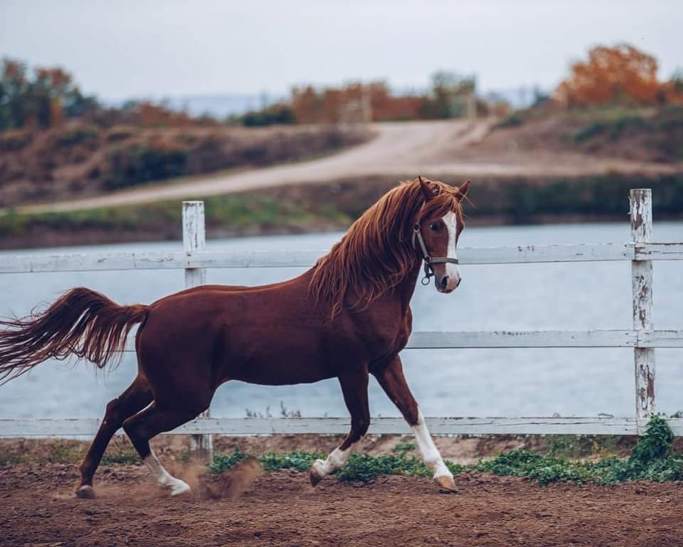
Karabakh horses are considered the most ancient horse breed in Asia and Caucasus. Investigators suppose that Karabakh horses are from the family of Manna, Median, Atropatenian, Albanian horses. The height of Karabakh horses is 148,5cm, breast is 165,8 cm, the circle of foot is 18,3 cm. They are golden- red and brown horses.
Karabakh horses could keep their origin although they were exposed to certain changes as a result of interaction with Roman, Sasanian, Arabic, Selcuk, Mongol, Iranian and other horses. The breed of Karabakh horses got much better in XVIII-XIX centuries. Karabakh horses had a great impact on Turkish, Iranian, Georgian, North Caucasian , Russian, Kazakhstanian, as well as Western European horse- breeding.
“The Book About Horses” writes:” Thank to Karabakh horses modern Don Horses are golden today.” Karabakh horses took places of honor in some international shows and races, won awards and medals. In races Karabakh horses participated with the names “Monkey”, “ Tokhmakh”, “Aghalar” , “ Bayram”, “Zaman” , “Garagozlu”, “Gafgaz Gozeli”, etc. and won many times.
At present, Karabakh horses take a special place among famous horse breeds like “Budyonni”, “Don”, “Arab”. The normal gait of a Karabakh horse is more than 8km.
Reserves and Conservations
Besitchay State Reserve
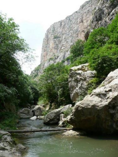
Besitchay State Reserve was set up in Zangilan region with the decision of Azerbaijan government dated July4, 1974. The reserve lies in the southern-west part of Azerbaijan, in Besitchay valley. The landscape complex of the reserve area was formed to protect the rare plane forest. Now its total area is 107 hectares. The lengh of its area is 15km, the width is 150-200m in some places. The reserve is encircled with the area of forest resourse of Armenia. 79,4 % of the area was covered with a forest, 14% is a sparse wood. The woodless areas is 6.5%.
The area covered with the forest is 600-800 m above sea-level and mainly mountainous. The climatic condition of the area is very propitious for natural recovery and growth of the plane forest. The annual amount of sunny hours is totally up to 2200-2500. The annual average temperature is 13degrees, 10 degrees in January, up to 25 degrees in July.
The amount of yearly rainfall is 600mm. The snow cover is 10-30cm, during some years is up to 70-80cm. The relative humidity of the weather is 60-70%.
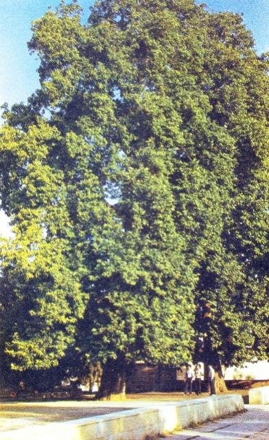
100 hectares of Besitchay State Reserve area is covered by plane forests. There are mixed plane groves too. Here also grow greek nut, mulberry,williow,poplar trees, hawthorn, dog-rose, brimstone,blackthorn, etc bushes. The avearge age of plane trees in the reserve is 165, the average height is 35m, the average diameter is 1m. There are also species of up to 1200-1500 years old, 50 m height, 4m diameters. The wood stock of the forest is 190 cubic metres per a hectar, 16200 cubic metres per the whole area. The annual upgrowth of the forest is 1,22 cubic metres per a hectar. There are different suppositions about the origin of plane trees. Some investigators see them like the remainders of old natural forests. (A. A. Grossheim), others suppose they are the remnants of widely spread plane –groves in river valleys of South- Western Caucasus. (L.Y. Prilinko, Y.S Safarov)
In Besitchay woodlands the planes propagate by means of seeds and shoots. Here 80% of the planes generate with shoots, 20% with seeds. One of the giantest tree in the reserve is 1200 years old, 53m high, with 4m diametres. There have appeared 185 shoots out of its corpulent trunk. These shoots are also like giant trees, the biggest one among them is 100-150 years old and 40 m high.
As a birch has a symbolic meaning for vegetation for Russian and Lebanese people, Azerbaijanis also chose a plane like a symbol of our flora historically and looked up to it. We have enough grounds for it. A plane tree is as stately as our people and nature, as ancient as our history. Planes are charms, adornment, pride , and longing of our nature. Unfortunately, such wealth of Azerbaijan has been ruined by Armenian invaders since 1993, those forests have been plundered and exploited in furniture production.
Garagol State Reserve
Qaragol Interrepublics State Reserve was set up with the decision of the Counsil of Ministers dated November17, 1987. Garagol State Reserve is located 2658m above sea-level in the borderline of Lachin region with Gorus region. The totl area of the reserve is 240hectares.
Ishikhli Garagol is in the south part of Karabakh Volcanic mountain range, which is 2658m above sea-level, in the source of the Aghoghlan river – the right tributary of Hekeri river, in the north foothills of Boyuk Ishikhli mountain (3548 m). It is surrounded by Demirdash and Kichik Ishikhli mountain in the north-west (3452 m), Janqutaran mountain in the north (2790 m), low moraine bloc in the east. This lake is a relict water source which reminds vulcanic crater. Garagol region is in the rocks of upper Pliocene age.
The length of the lake is 1950 m, the maximum width is 1250 m, the length of coastline is 5500m, the maximum depth is 7,8 m, the basin area is 13 square metres. The volume of water in the lake is calculated 10 million cubic metres. The water transparency of the lake is 4,6 m. The bottom of the lake near the coast consists of stones of different sizes. Towards the centre of the lake the size of rocks becomes diminished , and finally in the centre it comprises finely granular sediments.
From the second half of October till the end of April it is frozen. The thickness of the ice is more than 50cm up to 20-25 m distance from the shore towards the centre. The snow is up to 40-45cm thick here.
There are 102 species and semi- species of plants that consist of 68 species and 27 families.
Although there is no water flow into the lake, and since its water is pure and lifegiving, people used to visit there as a holy place.
In 1964s, the construction of cattle- breeding farms on the shore of the lake in the Armenian part, the usage of its water in irrigation of sown areas of Goruz region by building powerful pumping stations in the lake caused the lake pollution as well as reduction of water level in the lake. Those times discontents of people of Lachin region limited a little their exploitation. At present, the intensive usage of the lake water, which remains beyond notice, may lead to inevitable negative impacts.
Lachin State Reserve
Lachin State Reserve was established in the area of Lachin region in November,1961. The purpose of the formation of the reserve is to protect and increase birds and animals. Animals -roes, goats, wild boars, bears and so on, birds- partridge, ptarmigan, etc. have settled in the reserve. The total area of the reserve is 21,4 hectares, and it comprises 0,25% of the republican area, 8,8% of the area of republican reserves. 7369 hectares or 34,5% of the area is forests, 1448 hectares or 6,8% is alpine meadows, 7400 hectares or 34,8% is subalpine meadows, 4257 hectares or 20% is pastures, 862 hectares or 4 % is rocks and landslides, 34 hectares are lands of special purpose.
The peak is Qirkhqiz (2825m), it was abruptly shattered by deep valleys where the Shalva, Pijanis, Gorchu, and other rivers flow. The cold climate type with dry winter prevails in the area of reserve. The area of the reserve is divided into zones of the middle mountain and forests of Iberian oaks (1000-1700m), the upper mountain and forests consisting of eastern oaks (1700-2200m), subalpine (2200-2500m) and alpine lawns. The forests mainly consist of hornbeam,lime, birch and other trees. The forests where hornbeams prevail is pretty few (8,1%) The mountin forests of oak, hornbeam, birch trees cover quite less area because of intensive pasturing of animals. Gray grasslands of droughty slopes and mesophyll lawns of relatively humid slopes for subalpine zone, predominance of meadows of different grass for alpine zone, and poor growth of alpine carpet is characteristics for it.
In the area of the reserve primitive, less thick, weedy, mountain, typical, gray brown mountain-forest with carbonate residuum, humus carbonated mountain-forest, typical and gray dark brown mountain and forest soils are spread.
In comparison with the forests the mountain zone and woodless areas of the forest zone are exposed much to agricultural activities of men like pastures.
Along with it, this area is very suitable for animals and birds to dwell here. Their numbers and species are quite enough.
There is the valuable tree of the world- red oak in Hajisamli forest, in the area of the reserve. During the tsarist government, the French made a cart road by incising the Girkhqiz mountain from Khankendi to make use of this tree, but they couldn’t realize it because the Soviet government was founded in that period. This tree is used to produce valuable furniture and to keep cognac alcohol. This tree is spread only in this reserve. Nowadays, these trees and other forests are being cut off.
Gubadli Reserve
Gubadli State Reserve is subordinated to Besitchay State Reserve, and it was established in the areas of Gubadli and Lachin regions. The reserve covers the north part of Gubadli region and the south part of Lachin region, and it consists of mountain gray areas. The purpose of the formation of this reserve is to protect the animals and birds especially roes, wild boars, pheasants , etc. The total area of the reserve is 20 thousand hectares , and it covers 8,2% of republican reserves. The landscape is charactererised with sparse forest, shrubberies , and gray soils out of forests. The area covers upper parts of low mountain areas. Here prevails temperate climate with dry winter. The average annual temperature is 12-13 degrees, the amount of rainfall is 550-600mm, evoparation is 750- 800mm. The average temperature in January is 0-5 degrees, 30 degrees in July.
The area mainly consists of red oak and hornbeam trees. Also, juniper, hawthorn, dogrose, blackberry shrubs are widely spread here.
The environmental factors create perfect condition for animals and birds’ dwelling here normally. Before this area was occupied, it had been calculated that 101 wild boars, 21 brown bears, 35 roes, 420 hares25 wolves, 310 jackals, 75 badgers habitated here. The partridges (560) are widely spread here. Pheasants, partridges, quails, pigeons are permanent inhabitants of these areas.
This reserve has been occupied for 20 years and Armenians exploit this treasure savagely.
Dashaltı Reserve
The reserve which was established in the areas of Shusha and Khojaly in 1988 for protecting rare nature composites covers the area of 450 hectares. It is included Topkhana forest, Kirs mountain, plain of Jidir duzu, the walls of Khojaly region. There is “Khan magharasi” (khan’s cave) dating back to the Triton century in tha reserve.
The area of the reserve is a natural museum of thick forests, shrubberies , and grass plants.. Oak, hornbeam, birch, lime,ash-tree, hawthorn, dogrose, cornel, medlar, apple, pear, cherry-plum, etc. trees and shrubs grow here. The area is rich in medicinal, endemic , and rare plants. Roes, wild boars, squirrels, hares, wolves, jackals , and dozens of bird species dwell here. At present the reserve is under occupation , and its work has been suspended. The reserve which has been under occupation since 1992 is being ruined now.
Arazboyu State nature Reserve
It was established with the purpose of protection and restoration of riparian forests in 1993. The total area is 2200 hectares.
It is subordinated to Besitchay state reserve, and it was set up on the bank of Aras river in the region of Zangilan which borders on Iran in June, 1993. The length is 50km, the width is 50-100m, in some places it is 200-250.
The main purpose in the formation of the reserve is the protection of fauna and flora. It has the climate of hot summer and mild winter. The average climate is 20-25 degrees (10 degrees in January), 35-38 degrees in the months of June and July. The reserve has fertile clayey soil. The area consists of trees which need more water. The soil and climate condition offer all necessary facilities for the normal vegetation and growth of plants. The approximate count of the animals living here before the invasion was done. It became clear that there were 300 wild boars, 7 brown bears, 350 foxes, 300 jackals, 15 wolves, 70 badgers , 12 roes . Furthermore, here dwell birds : partridges, pheasants, ptarmigans, quails, drake ducks.
At present, the reserve is under occupation, and its work has been suspended.
Rivers
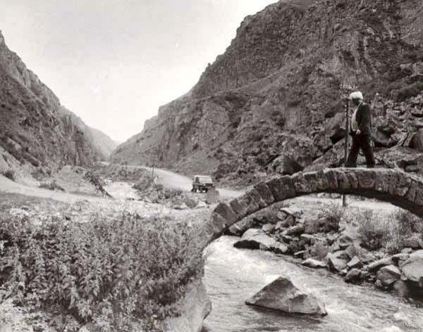
The rivers which start from the area of Karabakh mainly run into the rivers Kura and Araz or the rivers belonging to their basins. The peaks of mountains located in this area form watershed between river basins of Kura and Araz. Rivers here gather their water supply from rain and snow water and are used in irrigation. Tartar and Hakari rivers start from volcanic plateau. The sources of Arpachay (128 km) and Bazarchay ( 178 km) are found in the north-west part of the plateau. These rivers gather water from rain, soil, and underground waters, so they flood in the hot part of the year.
Tartarchay,Khachinchay, Gargarchay, Hekerichay, Okhchuchay, which flow in the south-east slope of Lesser Caucasus, are of big importance in the irrigations of Mil and Karabakh plains.
River Tartar – takes its source from the region of Kalbajar. It runs through the areas of Aghdere, Tartar, and Berde regions and flows into the river Kura. The tributaries of river Tartar are Tutgu, Lev, and Ayrim rivers. The altitude difference between its source and outfall is 3117m. Sarsang reservoir was built on the river.
Khachinchay – takes its source from the region of Kalbajar. It runs through the areas of Aghdam, Tartar, and Berde regions and flows into the river Kura. The length of the river is 119km. The altitude difference between its source and outfall is 2090m.
Kondelenchay – takes its source from the city of Shusha. It runs through the areas of Khojavend and Fizuli regions and flows into the river Araz. The length of the river , which is the left tributary of river Aras, is 102km. The altitude difference between its source and outfall is 1780m.
River Bergushad (Bazarchay)-takes its source from the republic of Armenia. It runs through the areas of Kalbajar, Gubadli, and Zangilan regions and flows into the river Araz. The length of the river , which is the left tributary of river Aras, is 164km. Agha, Bekhtiyarli, and Davudlu small river tributaries through Gubadli run into this river. The river pollution is caused by industrial and domestic wastewater from big residental precincts in the riverby areas ( in the area of Armenia). The rich fish species of the river is being plundered by armenian invaders. Mostly, fish are mass killed with chemicals.
River Hekeri- takes its source from 3080 m altitude of the region of Lachin and runs through the areas of Gubadli and Zangilan regions and flows into the river Araz. The length of the river , which is the left tributary of river Araz, is 128km. The altitude difference between its source and outfall is 2812m.
The water of the river is used for drinking and irrigation. Valuable fish types farel, omul, etc. spawn in this river.
Okhchuchay- takes its source from the mountain range Zengezur (Gapijik mount) and runs through the area of Zangilan region. The length of the river , which is the left tributary of river Aras, is 85km. The altitude difference between its source and outfall is 1780m.
Chemically contaminated water of Gajaran copper-molybdenum, Gafan copper ore refining group of enterprises, as well as biologically waste water of Gafan , Gajaran cities ( including villages , hospitals, agricultural facilities) without purification run directly into Oxchuchay, the river in front of Sherikan village of Zangilan region, so it converts the river basin into “ The Dead zone”.
Besitchay- being the left tributary of river Araz, takes its source from the republic of Armenia. The length of the river is 44 km. (17 km is in the territory of Azerbaijan) The river is polluted with the swine farm waste of mountain villages of Armenia.
River Gargar- takes its source from 2080 m altitude of the region of Shusha and runs through the areas of Khankendi, Khojali, Aghdam, and Agjabedi regions. It is formed by the junction of Zarisli and Khalfeli rivers. The altitude difference between its source and outfall is 2080m. The main tributaries are Ballija, Bedere, Daghdaghan, etc.
Chaylagchay- is the left tributary of River Aras. It runs through the region of Jabrayil. Its length is 32m. It takes its source from the bottom of Lesser Caucasus. (1750m). Its flow is made by rain waters. Its water doesn’t run into the outfall since it is widely used in irrigation.
Sources:
www.virtualkarabakh.az
Materials of Besitchay State Reserve


